
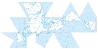
Maps:
Brigham Young University in Utah has a page of downloadable maps in pdf format.
The Geography Department at the University of Nebraska at Omaha has a very good selection of maps in downloadable pdf format.
As does the UN map library, with country and thematic maps.
Create your own maps online using a basic GIS at indiemapper.
The Geography Department at the University of Nebraska at Omaha has a very good selection of maps in downloadable pdf format.
As does the UN map library, with country and thematic maps.
Create your own maps online using a basic GIS at indiemapper.
Useful sources of information:
The World Bank website contains a huge volume of up-to-date statistics. You can search by country or indicator.
The CIA's World factbook contains a wealth of background information and up-to-date statistics on every country in the world.
Nationmaster: "a massive central data source and a handy way to graphically compare nations. NationMaster is a vast compilation of data from such sources as the CIA World Factbook, UN, and OECD."
Geohive: "a site with all kinds of statistics population statistics: historical, projections, cities, agglomerations, etc. But also geopolitical data like the administrative divisions of countries (provinces, counties and such) of all nations."
